
Arbrium case study · Strategic road network
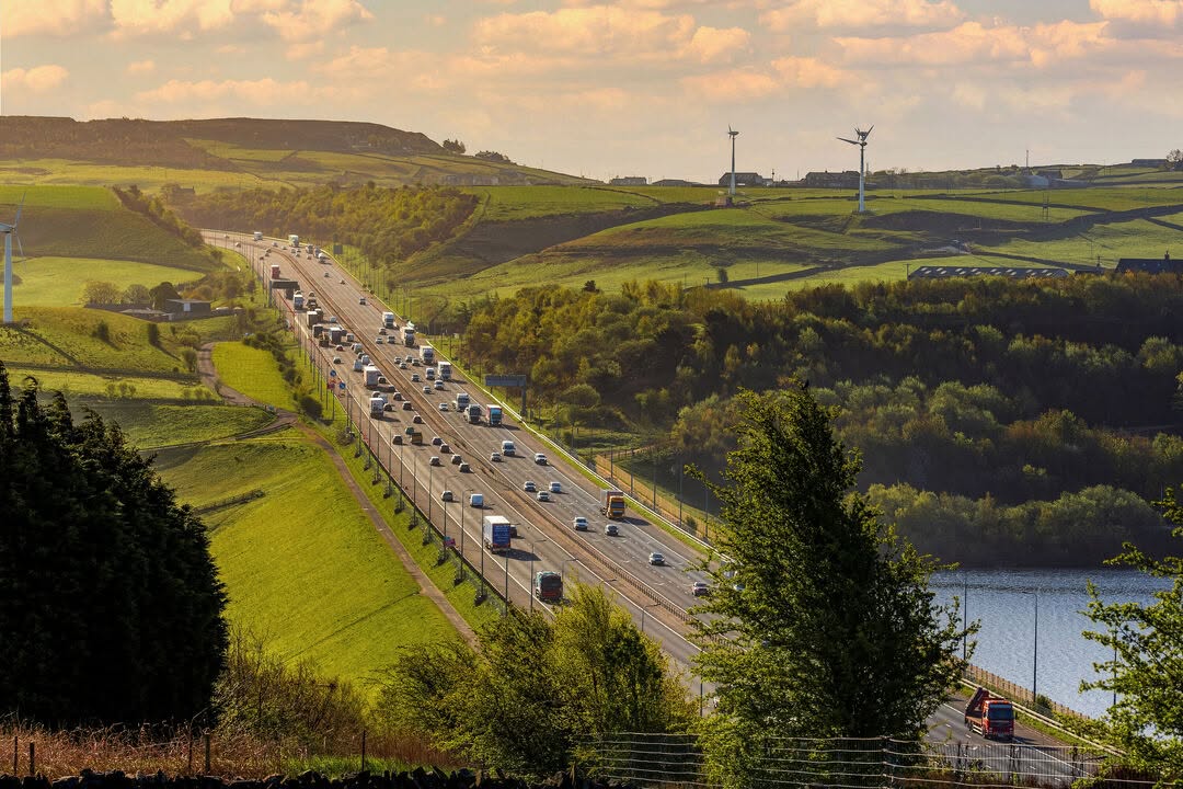
Ash dieback surveys on live motorway corridors.
Delivered by GVA for National Highways, with every roadside asset, inspection and photograph managed in Arbrium.


Client
National Highways (delivered by GVA)
Programme
Ash dieback and boundary condition surveys
Scope
Thousands of assets across live motorway corridors
The problem
Ash dieback surveys on the strategic road network have to be delivered inside a short summer window, on a live carriageway, often under traffic management. The trees are numerous, the access is difficult, and the client needs a defensible record of what was inspected, by whom, and what was recommended.
The delivery method that existed before was the one most of the industry still uses: a GIS layer supplied by the client, a spreadsheet carried into the field, photographs on a phone, and an evening spent reconciling all three. At the scale of a national network, that reconciliation is the bottleneck — and the point at which references drift, photographs detach from records, and duplicate rows appear.

What we built
Arbrium started as the tool this programme needed and grew into a platform. The client's GIS data imports directly — including British National Grid shapefiles, reprojected on the way in — so surveyors work against the client's own asset references from day one.
In the field, a surveyor opens the project map, taps the tree, and records the inspection against it. Photographs attach to that inspection. Trees missing from the import can be added on the map or captured in one tap from a moving vehicle. Linear belts and woodland blocks are drawn as geometry rather than approximated as points. Planned surveys group the day's work and assign it to a named surveyor, with the method — foot, desktop or drone — recorded up front.
Progress is visible on the map as it happens: surveyed assets separate visually from outstanding ones, so the programme can be managed mid-season instead of assessed at the end of it.
One system of record
Assets, inspections, photographs and sign-off live against the tree itself, so the history of any single asset opens in seconds rather than being reconstructed from archived files.
No transcription step
Surveys are captured in the field against the mapped asset. There is no evening spent typing up paper sheets, and no second chance to introduce an error.
Evidence that holds up
Every photograph is tied to a specific inspection, surveyor and date — the record an asset owner needs when a claim asks what was known, and when.
Exports in the client's format
Survey data leaves Arbrium in the spatial formats the client's own portal expects, with date-range and selection filtering for periodic returns.
Beyond trees
The same programme now runs boundary and fenceline condition surveys through Arbrium — hundreds of kilometres of fencing captured as measured linear geometry, grouped by road reference, with National Highways WBS codes and digital sign-off built into the survey form. A dedicated insights dashboard turns that into a print-ready summary for the client.
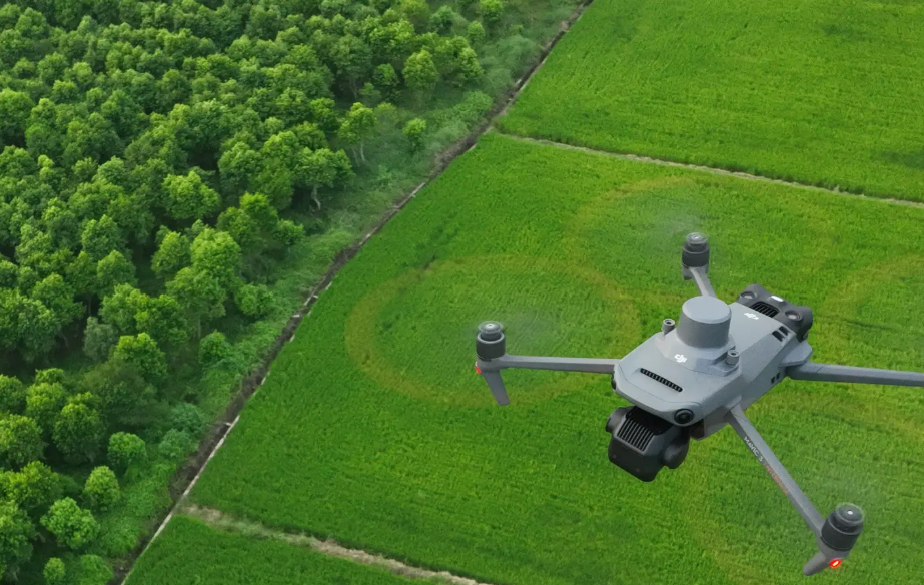
Arbrium Air extends the same asset model to drone survey, with mission planning and pre-flight checks on the controller itself and captured evidence syncing back to the same assets.

Desktop mission planning, automated DJI flight capture and AI-drafted survey reports — all tied back to the same asset record.
What's next: Home Safe and Well.
We are piloting tree surveys with drone capture on live motorway corridors. The principle is the same one National Highways works to across its network: Home Safe and Well. Every asset inspected from the air is one less surveyor working beside live traffic, and a drone covers ground that takes a surveyor on foot hours in minutes.
Drones already survey trees across the industry. What Arbrium Air adds is the desktop planning that turns a flight into a field operation: missions are planned in Arbrium against the same mapped assets, downloaded directly to the controller, and flown automatically — capturing geo-referenced evidence that syncs back to the same tree record. Built-in AI then drafts a structured report from that evidence for the surveyor to review and approve. The surveyor stays the decision-maker; the software removes the legwork.
Arbrium Air is in live pilot. Read more about aerial tree surveys.
Why it matters
Vegetation risk on national infrastructure is a standing liability, not a project. The value of a survey is not the survey — it is being able to answer, years later, what was known about a specific asset on a specific date. Arbrium exists so that answer takes one click.
More background on the underlying methods: ash dieback surveys and tree safety inspections.
Running a programme like this?
Arbrium is live on the strategic road network today. If you deliver vegetation or boundary surveys at scale, we would like to show you how it works.