
For infrastructure asset owners
Every supplier's data. One view of your assets.
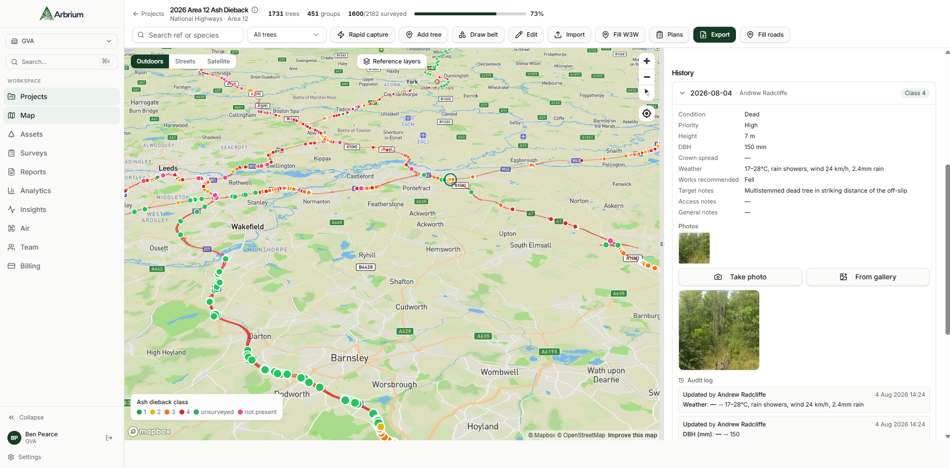
Your network is surveyed by many contractors, on many contracts, in many formats. Arbrium is the central asset intelligence hub that brings it all together. You see the condition of every asset, what it is linked to across your portfolio, and which work belongs together, before you commit a programme.
The problem
Your asset data is spread across contracts, not connected across your portfolio.
01
Bring in what you hold
Your asset register and boundary layers become the base map. References stay as you issued them.
02
Plug in every supplier
Survey returns from any contractor land on the same assets, whether they surveyed in Arbrium or in their own tools.
03
See what is linked
Arbrium finds where assets, findings and planned works touch each other across projects and suppliers.
04
Plan the programme
Group work that belongs together, sequence it, and send a better record back to your systems.
Asset information management
What you get as the asset owner.
- Available
Import supplier data in any common GIS format
Shapefile, GeoJSON, CSV and Excel, with British National Grid converted automatically.
- Available
Suppliers survey in Arbrium or their own tools
Both routes update the same persistent asset record.
- Available
Read-only access across every project
Your team sees all suppliers' work. Each supplier sees only what you share.
- Available
Linked assets across projects
Trees near boundaries on other contracts, and potential grouped work.
- Available
Live progress and condition findings
- Available
Returns in your GIS standard
Point, line and polygon layers with your references intact.
- Planned
Direct connections to supplier and owner systems
- Planned
Drainage, structures, lighting and signs
Planning programmes of work
Plan from connected data, not contract by contract.
- See where a felling programme and a boundary renewal fall on the same stretch, and book one closure instead of two.
- Spot assets surveyed by one supplier that another contract depends on.
- Prioritise by condition across the whole network, not one survey at a time.
- Keep a full history of who found what, when, with photos and provenance.
Questions
Common questions from asset owners.
Do all our suppliers have to use Arbrium?
No. Suppliers can survey in Arbrium, as GVA do on National Highways work, or keep their own tools and hand over data. Arbrium brings the returns into the same asset record either way.
What formats can supplier data come in?
Shapefiles (zipped or as separate files), GeoJSON, CSV and Excel. British National Grid and Web Mercator coordinates are detected and converted automatically, and the supplier's asset references are kept.
Does Arbrium replace our asset management system?
No. Arbrium sits between your register and your supply chain. It takes in the data you hold, improves it through inspection, and returns a better record in your GIS standard.
Who can see our data?
You decide. Each supplier sees only the projects you share with them, and your own team gets read-only access across all of them.
See your portfolio in one view.
Send us a sample of your asset data and a supplier return, and we'll show you them connected.