
Survey & inspection
One asset record. Multiple ways to inspect it.
From boots on the ground to autonomous inspection. Arbrium doesn't mind how the evidence is captured — every method adds structured observations and evidence to the same persistent asset.
Technology-agnostic
The inspection technology can change. The asset stays put.
Field surveyors
AvailableProgramme templates on a phone or tablet, against the mapped asset.
Rapid capture
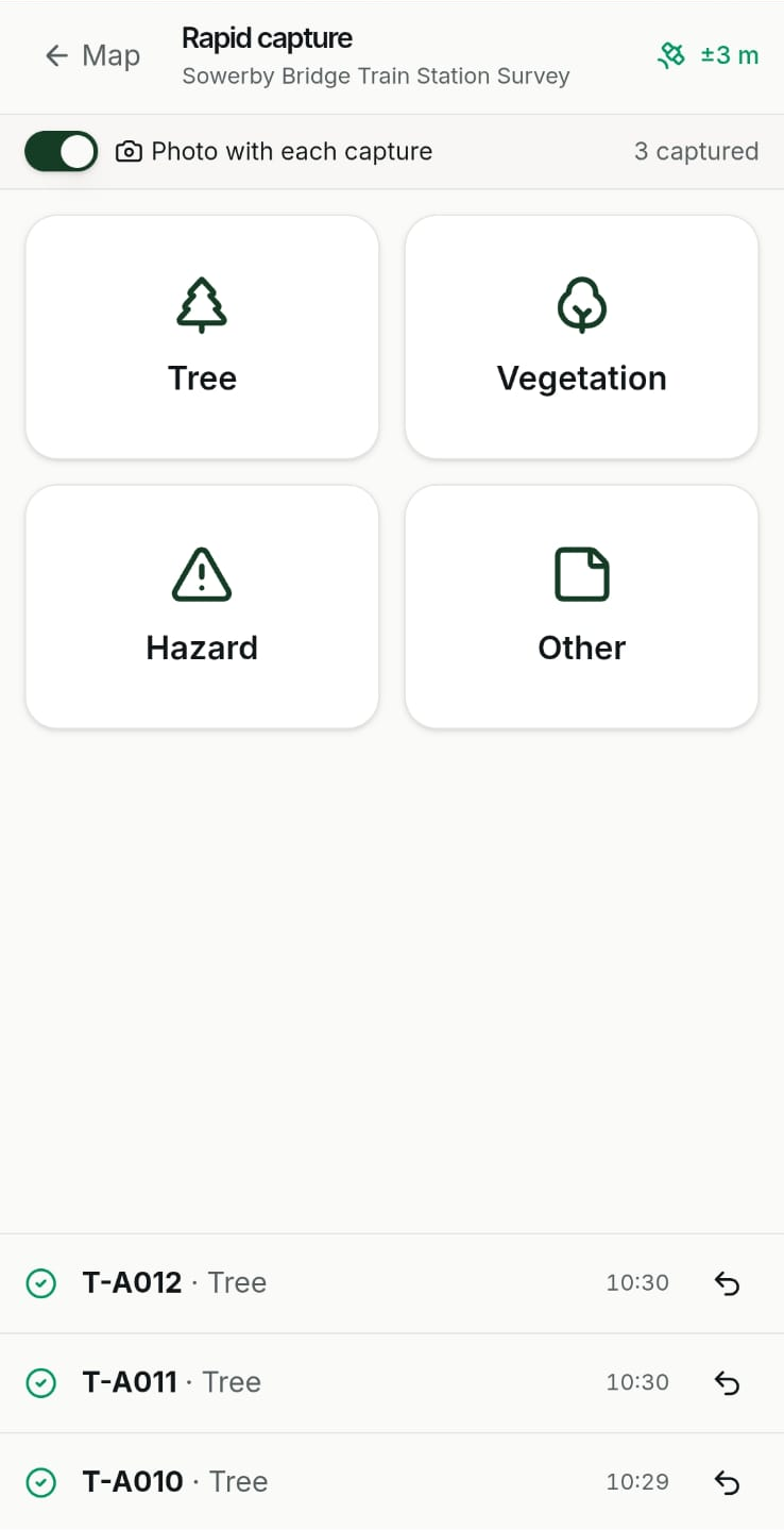
AvailableOne tap records GPS and a photo for anything not on the map.
Drones — Arbrium Air
In betaMissions planned from the asset list; imagery lands on the asset.
Imported datasets
AvailableEarlier surveys and client baselines loaded as asset history.
THE ASSET
One persistent record
Every observation, photo and finding lands here — whoever or whatever captured it.
Third-party systems
PlannedInspection results from other platforms, matched to the asset.
Vehicle capture
PlannedCorridor imagery and survey from moving vehicles.
Ground robotics
PlannedAutonomous ground inspection where people shouldn't go.
Sensors
PlannedContinuous readings attached to the assets they monitor.
Field capture
See it. Capture it. Keep moving.
Survey against the client's own assets
The client's asset layer is the map. Tap an asset, record the inspection against it.
Rapid Capture
One tap records GPS position and a photo against a tree, vegetation, hazard or other point — survey it properly later.
Automatic references
New assets are numbered in sequence per project, so references never clash between surveyors.
Points, lines and polygons
Place a tree, draw a belt or woodland block, or trace a fenceline as a measured line.
Templates per programme
Each programme gets its own form, with the fields and condition classes the client audits against.
Context filled in
Road reference and what3words across a project in one click; weather recorded against every survey.
Professional review
AI prepares. Professionals decide.
Where imagery is captured — by drone today — Arbrium can prepare draft observations for a qualified surveyor to review. Drafts are clearly marked, and nothing is published until a person approves it.
Every inspection records who carried it out, how it was captured and when, so the asset's history shows exactly where each finding came from.
- Available
Field surveys on phone and tablet
- Available
Rapid Capture of missing assets
- Available
Configurable survey templates
- Available
Imported baseline surveys as asset history
- In beta
Drone missions and evidence — Arbrium Air
- In beta
AI-drafted observations for professional review
- Planned
Offline survey in the web app
The Arbrium Air controller already works offline.
- Planned
Third-party inspection systems, vehicle capture, robotics and sensors
Arbrium Air is the first autonomous inspection channel.
Missions planned from the assets that need inspecting, checked against the client's drone policy, and evidence returned to the right asset.